Monday, October 26, 2015

Lasts and Firsts

As this post is being written on Monday, October 26, we are tied up snugly at Eastern Shore Marine in Fairhope, Alabama (on the eastern shore of Mobile Bay) watching the remnants of Hurricane Patricia inundate the area with rain. Still, we are very happy to be here and not stopped at some anchorage along the river. Timing is everything, and we are exactly where we had hoped to be when the days and routes were being drawn up. We had great weather when we needed it for cruising the rivers and now we have rain and wind for a couple of days when we can use the break.

It's pouring out there, and the fixed docks (the wood under the
yellow power cords) are only about 6 inches away from
being underwater.
When we left Kingfisher Bay Marina in Demopolis, AL on Friday, October 23, we knew that we wanted to be done with the river cruising and at a marina on the Gulf coast before the predicted bad weather hit. This meant boating from dawn to dusk on October 23 and 24 to keep our anchorages to two, and a similarly early start on October 25 in order to get across Mobile Bay to Fairhope as soon as possible that day. Initially we were on the Black Warrior-Tombigbee River system, and then the Mobile River. Frankly, only the names changed. The riverscape continued to be pretty and serene, but it was much the same as it had been on the Tenn-Tom--Water. Trees. Locks (but only a couple).

Hints of fall color at "Lover's Leap". The trees
at the bottom of the cliff were tenaciously growing
out of the rock.
Water like glass on October 24
Ezell's Fish Camp, an Alabama institution. Started
in 1937 and housed in a Civil War era building, but
there was no place for a boat to tie up for lunch.
The past few days have given us some "Lasts and Firsts":

The Last Lock: Pat in the Coffeeville, AL
lock on October 24

The Last River: The Mobile skyline along the Mobile
River (and harbor) on October 25

The First Brown Pelicans: a sign of our proximity to
salt water, spotted at mile 19 on the Mobile River

The First View of Mobile Bay: a small fishing boat is at
 the foreground of the entrance to Mobile Bay. We
can imagine the Gulf of Mexico in the distance!
Getting through the harbor at Mobile and transiting to the east side of Mobile Bay were the big challenges for October 25. Mobile is a significant port city, not just for river traffic, but for ocean-going ships as well.

Meeting and passing the "Whistler Spirit" in
Mobile Harbor as it was being escorted to its
dock by pilot boats
Too many AIS targets in Mobile harbor. Good
thing most of the associated boats were docked
 and not moving
Manufacturing Navy ships

The water on Mobile Bay was a bit choppy as we left the more protected confines of the harbor. Fortunately, we didn't have too far to go. The direction of travel to the marina had us mostly meeting the waves on the bow of the boat, so we weren't rocked too much or for too long. After two nights "on the hook" it's nice to be close to a town and services.

In 27 cruising days we have completed 1603 miles, essentially all of it on various rivers. After a few more cruising days covering approximately 220 miles on the Gulf Intracoastal Waterway we should reach Appalachicola, Florida. There we will wait for a weather window that will allow us to cross the Gulf of Mexico to St. Petersburg in safety and comfort.  

Thursday, October 22, 2015

Son of Tennessee Valley Authority?

Well, not really. The Tenn-Tom (Tennessee-Tombigbee) Waterway that we cruised from Sunday, October 18 to Wednesday, October 21 was a waterway project unconnected to the TVA project on the Tennessee and Cumberland Rivers. The idea was similar, however--create a commercial waterway that could be used in lieu of the Mississippi and decrease trip distances for commercial traffic. Although the idea was first approved in 1946, the first funds weren't allocated until 1968, construction wasn't begun until 1972, and it didn't open until January 1985. It is 234 miles long and runs from the Tennessee River at Pickwick Lake in the north to the junction of the Black Warrior and Tombigbee Rivers near Demopolis, Alabama.

The past four days of cruising can be described in three words: water, trees, locks. Probably because the Tombigbee River wasn't an active commercial waterway prior to the creation of the Tenn-Tom, there aren't any towns to speak of and few marinas. It's a beautiful waterway and non-stress cruising, but after a while it's All. The. Same. So the cruising miles per day for us continues to be longer this fall than it was during our Loop last year. Fog permitting, we try to be underway by sunrise at 7 a.m. We have been disappointed that, although we are moving downstream, we don't seem to be getting much of a current assist.

Life on the Tenn-Tom: Water. Trees.

The most striking sight along the Tenn-Tom: the
White Cliffs at Epes, Alabama

Close-up of the White Cliffs. Part of the "Selma Chalk
Formation" and said to be of the same geological
age as the White Cliffs of Dover (England)

Spanish moss--we must be back in the South

With one exception, we have made our "target destination" each day. The exception was Monday, October 19. With 60 miles and four locks to complete, we needed all of the cruising elements to align. Alas, it was not to be. A foggy morning delayed our departure from Midway Marina (near Fulton, MS) for an hour. We got through the first lock of the day just fine, but for the next two found ourselves behind a slow, barge-laden tow which delayed us for at least an hour at each lock. By the time we got through the last lock at Aberdeen (thanks to a kind lock master who delayed the last pleasure craft lockage for us so that we didn't have to anchor on the upstream side of the lock) we were still 20 miles from the marina at Columbus, MS, it was late afternoon, and we were tired. We found a very peaceful anchorage off-channel 10 miles down river and spent a restful night at the Barton Ferry Cut-off. We were able to make up the other 10 miles during our cruise on Tuesday, October 20--which was another night at anchor.

Waking up to fog on the river
 on October 19 at Midway Marina
Zipper on deck at Barton Ferry
 Cut-off anchorage

Our tow boat nemesis on the 19th, Green Wave. It almost
became a problem for us on October 20 as well,
but we passed it during a crew change. Relief!

CARIB at anchor in Sumpter
 Recreational Area on October 20.
Sunrise at our anchorage in Sumpter Recreational Area.
We had one neighbor during the overnight.

Locking has been an interesting process on this waterway. Pleasure craft going through one lock together tend to have to stay grouped for subsequent lockages (as long as the locks are just a few miles apart). It doesn't help the "go fast" boats to go 30 mph because they end up waiting for the "go slow" boats to reach the locks.

Boat convoy leaving a lock. Besides these three behind us,
there were three boats in front of us.
We reached the end of the Tenn-Tom Waterway yesterday (Wednesday, October 21) and are at a very nice marina in Demopolis, Alabama for a couple of nights. Grocery shopping, laundry, cleaning, and eating out are all on the agenda. We are still awaiting word from our insurance agent about our request for a waiver to continue south of 30 degrees north latitude prior to November 1, but are hopeful it will be approved. As long as Hurricane Patricia (is it weird that I'm somewhat pleased to have a hurricane with my name?) stays in the Pacific and no tropical storms develop in the Gulf of Mexico we should be OK. As there are no marinas in the 217 miles between Demopolis and Mobile Bay, we will be anchoring out for two or three nights. Our Verizon reception has been generally terrible during our cruise this fall, so it remains to be seen how "out of touch" we will be until we reach Mobile Bay on Sunday (waiver and weather permitting).

Telephone booth in the middle of nowhere. Bet the
connectivity is better than we have with Verizon.

Wednesday, October 21, 2015

Shiloh

Although we do not consider ourselves Civil War aficionados, we have enjoyed visiting some of the important--and some not so well known--Civil War battlefields over the years. We are now cruising through areas rich in Civil War history, but the sites are not necessarily easily accessible from our stops along the way. However, one site on our "must see" list was the Shiloh National Military Park in Tennessee, the site of the Battle of Shiloh in 1862. On Saturday, October 17, we were able to use our marina's courtesy car to drive the 17 miles to spend a couple of hours seeing the highlights of the battlefield.

Lon and Pat inside the reconstructed Shiloh
Meeting House, the log Methodist church that
gave the battle its name
The Battle of Shiloh was fought over two days, April 6-7, 1862. In an effort to stem the Union advance toward the important rail junction of Corinth, Mississippi, Confederate General Albert Johnston led 44,000 Confederate soldiers in a surprise attack against the Union forces of Ulysses S. Grant encamped at Pittsburgh Landing, Tennessee. The attack was very nearly successful, but a premature cessation of fighting on that first day, and the subsequent arrival of Union reinforcements, turned the tide and the Confederate Army was driven back toward Corinth on April 7.

Shiloh was a bloody, bloody battle that resulted in just under 24,000 dead, wounded, or missing. Two days of fighting had resulted in more casualties than all the previous wars of the US combined, and with no net gain of territory for either side. It was a harbinger of the bloodbaths that would follow before the Civil War drew to a conclusion in 1865.

Lon in the National Cemetery at Shiloh. The small
stone blocks mark graves of unknowns. This was the
area of Grant's army encampment and his "Last Line"
prior to the counterattack of April 7.

One of five known mass graves where many of the
over 1700 Confederate dead were buried.
Kudos to the US Park Service for the design of the military park. They had a great movie in the Visitor's Center that laid the groundwork for the driving tour around the battlefield. Many landscape features still exist from the period, making it easier to imagine how it was during the battle.

Pat at the Minnesota monument

View of Pittsburgh Landing on the Tennessee River.
We boated by this site on October 15.

View down the "sunken road", an old
wagon path that was the site of
intense fighting at the "Hornet's Nest"
woods (at left)

Friday, October 16, 2015

In the Land of the Tennessee Valley Authority

When we passed through Barkley Lock on October 11, we passed into an area that was greatly affected by the Tennessee Valley Authority (TVA) projects of the 1930's and 40's. A New Deal program designed to make the Cumberland and Tennessee Rivers navigable, mitigate flooding on the Ohio and Mississippi Rivers, and generate hydroelectric power focused on building a series of dams. The completion of the dams resulted in the flooding of the land upstream of the dams and the creation of artificial lakes, the largest of which is Kentucky Lake. Lake Barkley is its counterpart to the east, and the park area between the two reservoirs is known as "The Land Between the Lakes."

What this all means is that essentially we have been cruising through a huge resort area for the past few days where boating and fishing are paramount. Aside from a few groupings of homes here and there, the landscape is mostly natural. Unlike our cruising on much of the rest of the Great Loop, the marinas are quite self-contained and not often near towns. So we boat during the day for seven or eight hours, then hang around in our marina for the evening. We socialize with other Loopers when possible, but there isn't much land-side exploration to be done.

Leaving Green Turtle Bay Marina
Grand Rivers, KY

Finally! Ice cream in Grand Rivers. They had a German
Chocolate "hurricane" (like a DQ Blizzard) that was
awesome!

We are grateful to have had absolutely gorgeous, sunny weather for our cruising. Fog on the water has been an issue a couple of mornings, but it's usually burned off by 8:30 or 9 a.m., so it hasn't delayed us much. Because the waterway is so wide, and the commercial boat traffic scarce compared to the Mississippi, it has been a very relaxing area to cruise. The only negative aspect has been that, although we are cruising south, we are going "upstream" on the Tennessee. Current against us wasn't a big issue in the wider part of Kentucky Lake, but as the river channel narrowed it became more pronounced and we found ourselves increasing engine rpms to maintain a reasonable speed. (And as engine speed goes up, fuel mileage goes down.)

Former grain shipping warehouse
 flooded by the
Kentucky Dam project
Docked at Pebble Isle Marina near
New Johnsonville, TN (Old Johnsonville was flooded
by the Kentucky Dam project). This was the site of the
Battle of Johnsonville in 1864--the only time in military
history that a cavalry force defeated a naval force


Lady Finger Bluff. A legend from pioneer days says
that a lady leaped to her death from this site rather
than be captured by attacking Indians.

Anti-flood architecture on the Tennessee. The house has
a heavy concrete lower level. $25,000 for a lot if you
want to take your chances with flooding.
Fishing on a foggy morning at Clifton, TN

George Washington didn't stay in
Clifton, nor did Mark Twain, but they
do have a historical sidewalk!

We cruised yesterday by a portion of the Shiloh National Military Park, the site of the Civil War Battle of Shiloh in 1862.


Cherry Mansion, headquarters of General Ulysses S. Grant
during the Battle of Shiloh
After passing through the Pickwick Lock yesterday afternoon (October 15), we left Tennessee behind and are now stopped for a couple of days at Aqua Yacht Harbor in Mississippi. We'll spend today on maintenance and cleaning, then hope to drive to the Shiloh battlefield tomorrow.


Monday, October 12, 2015

Long Days

On Thursday, October 8, we left Port Charles Harbor in a light fog. Three miles or so downriver we "crossed our wake" (from last fall) at the junction of the Illinois and Mississippi Rivers and rejoined the Great Loop route.

Pretty early morning scenery north of St. Louis
Lon takes Zipper outside in the Chain of Rocks Lock


The day's cruise took us by the city of St. Louis and its famous Arch. It wasn't quite as exciting as passing by the Statue of Liberty last year, but it wasn't bad. It's a good thing we visited the Arch last fall on our drive south, because St. Louis has no place along their waterfront for pleasure craft to dock and visit the downtown attractions. It's a shame for a city that size.

The St. Louis Arch and downtown St. Louis
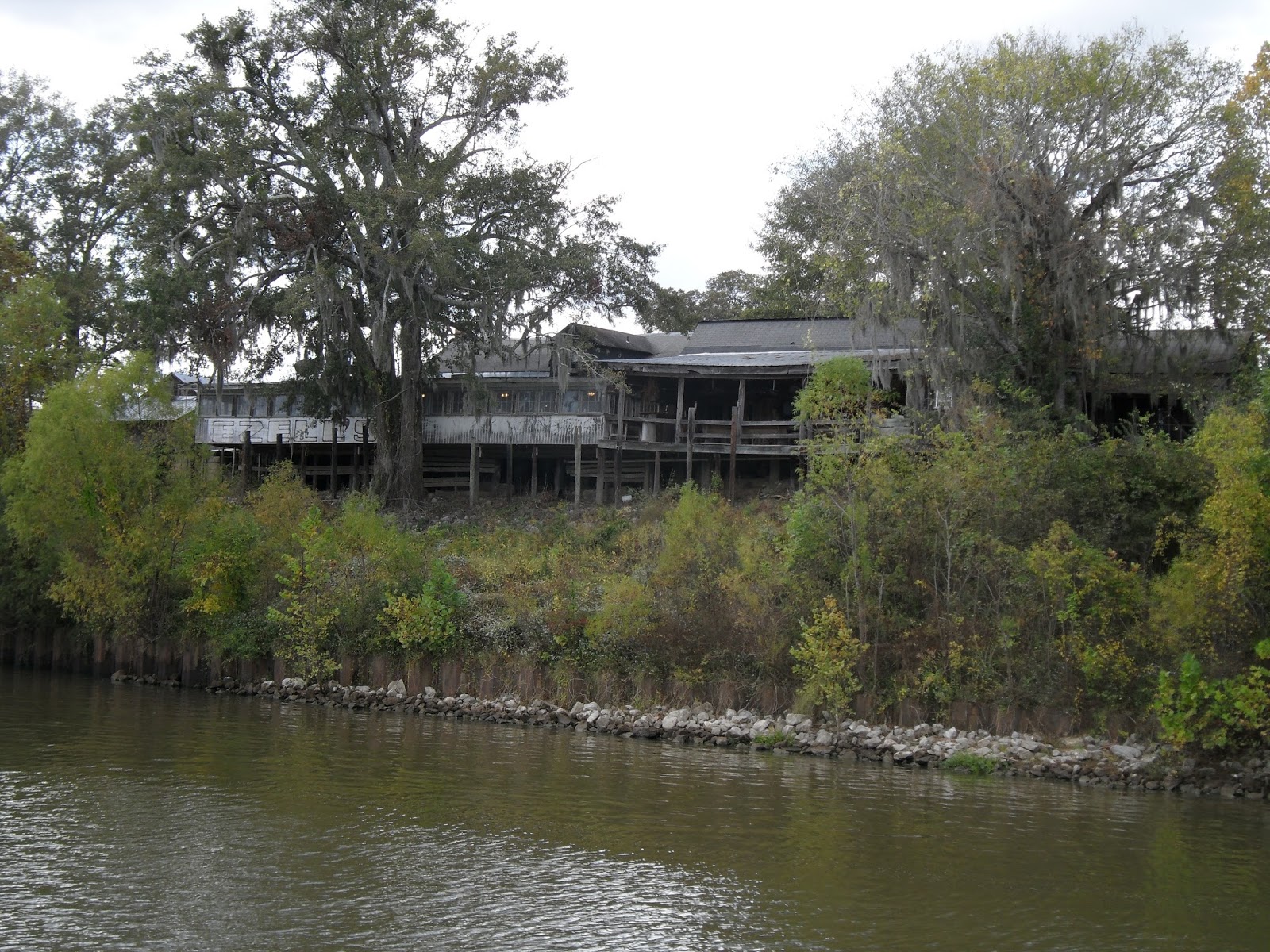
The riverfront is quite industrialized for a number of miles south of St. Louis, and the water noticeably dirtier than it was north of the city.

"Leg art" in the yard of a riverfront home

After 63 miles and 2 locks, our home for the night was Hoppies Marine Services in Kimmswick, MO (about 20 miles south of St. Louis). It's a stretch to call it a marina, because its "docks" consist of a series of 100-foot barges lashed together and secured to the shore with cables. Electric power is the only service offered. Most Loopers stop there because it's the only marina between St. Louis and the start of the Kentucky Lakes 200+ miles further on. It's a critical fuel stop for those whose traveling range will be challenged by the 228 miles before the next fuel stop.

A view down the "docks" at Hoppies
Marina. We later found out that we were
on the "Executive Dock"

October 9 and 10 were very long cruising days for us. With no marinas and few good anchorages on the 158 miles of Mississippi River south of Hoppies and 60 miles of Ohio River, we put a lot of miles under our keel. October 9 was a 9.5-hour, 110-mile, gray and drizzly cruising day before we finally anchored at the Little River Diversion Canal. The anchorage was quiet and deep enough, and, most importantly, out of the Mississippi River with its tow wakes and potential dangers from runaway barges.

Because there wasn't much to see besides trees and water in this part of the world, we tried to add a little excitement to the days by creating a travel game--"Count the Barges".  Just north of St. Louis we had traveled through the last locks on the Mississippi heading south: after Lock 27 the river is lock-free all the way to the Gulf of Mexico. This meant that the 15-barge-per-tow size limitation in place elsewhere on the Mississippi no longer applied. Therefore, in our remaining 180 miles on the Mississippi, part of the "excitement" was seeing just how many barges one tow could push.

A 4x6, 24-barge tow . . . 

A 6x6, 36-barge tow . . . 

The winner! A 6x7, 42-barge tow
Meeting or passing tows of this size had its challenges. We had to be in contact with the tow captains by radio to ensure that we were meeting or passing them on their preferred side, especially when the channel was relatively narrow or curved. As well, the tows pushing the largest numbers of barges used an incredible amount of power, and the waves they were throwing out behind them were huge.

Signals on our chart plotter from the
Automated Identification System (AIS) as we
approach the Ohio River. We are the black triangle-
the red triangles are commercial traffic.
On October 10 we left the Mississippi River at Cairo, IL and turned up the Ohio River. In doing so we entered a much wider, cleaner body of water, but lost a great deal of speed because we were now heading upriver against current.

First look at the Ohio River
The Ohio River's biggest challenges to boaters are possible delays at Locks 53 and 52. Both locks are old and are scheduled to be replaced by a new lock and dam under construction at Olmsted. Unfortunately, that particular project is a bit of a boondoggle--it was originally authorized by Congress in the late 1980's and has been under construction since President Clinton was in office in the 1990's. Many years and cost over-runs later, the current projected completion date isn't until at least 2020. In the meantime, boat traffic transiting the construction site and the essentially-defunct Lock 53 must wait to be led by an Army Corps of Engineers "helper boat".

Following a tow and barges through the
Olmsted L&D construction site
25 miles upstream of Lock 53 is the notorious Lock 52. Old and subject to breakdowns, the delays to river traffic at this lock are incredible. The main and auxiliary lock chambers have been under repair intermittently this fall, and we have seen lock queue reports where tows have waited several days to be locked through. After a 92-mile, 10-hour cruising day we arrived at the lock around 5 p.m., narrowly missing the day's last upstream lockage of recreational boats. The lockmaster gave us permission to anchor downstream of the dam so that we would be positioned to be locked through first thing the morning of the 11th. We had a 2-hour delay in the morning due to fog, but were through the lock by just after 9 a.m. Relief!

I-24 bridge at sunset, just south of our Lock 52
anchorage
Our view of Kentucky on a foggy morning
Unusual lock walls in old and decrepit Lock 52
Our destination for October 11 would be somewhere on the north end of the Kentucky Lakes. A shorter route via the Tennessee River would take us to Kentucky Lake at the top of the Kentucky Dam. Taking the Cumberland River to Lake Barkley via the Barkley Lock would be 20-miles longer, but less subject to delays at the lock. It was essentially a mental coin toss for us, but the conventional wisdom and telephone advice from a very friendly lockmaster at the Kentucky Dam steered us to the Cumberland River route. After 7+ hours of cruising we went through the Barkley Lock and its 57-foot lift into Lake Barkley and the resort marina of Green Turtle Bay in Grand Rivers, Kentucky.

CARIB II and one other boat in the
deep Barkley Lock

Pat stabilizes the boat amidship with a floating
bollard as we rise in the lock

We are spending Columbus Day at Green Turtle Bay to rest and run some needed errands. More on the "Kentucky Lakes National Recreational Area" when we continue our way south.